Welcome to Fort William
The Outdoor Capital of the UK. From sandy beaches and dramatic hills to iconic films locations, castles and distilleries, there are plenty of things to do in Fort William. Take your time and explore the natural wonders of Lochaber, breathe the fresh mountain air and marvel at some of the most beautiful beaches in the world.
You could climb Britain’s highest mountain Ben Nevis, explore the wilds of Ardnamurchan and the West Highland Peninsulas, the cinematic landscapes of Glencoe or take a stroll by the sea along the Road to The Isles, with magnificent sunsets over the Isles of Rum, Eigg, Muck, Canna, Skye and the wilderness of Knoydart.
History
Fort William is located at the confluence of the River Ness and Loch Linnhe at the south-western end of the Great Glen, a series of lochs that run through the Highland massif and which has historically been an important artery of trade and movement through the otherwise inaccessible terrain.
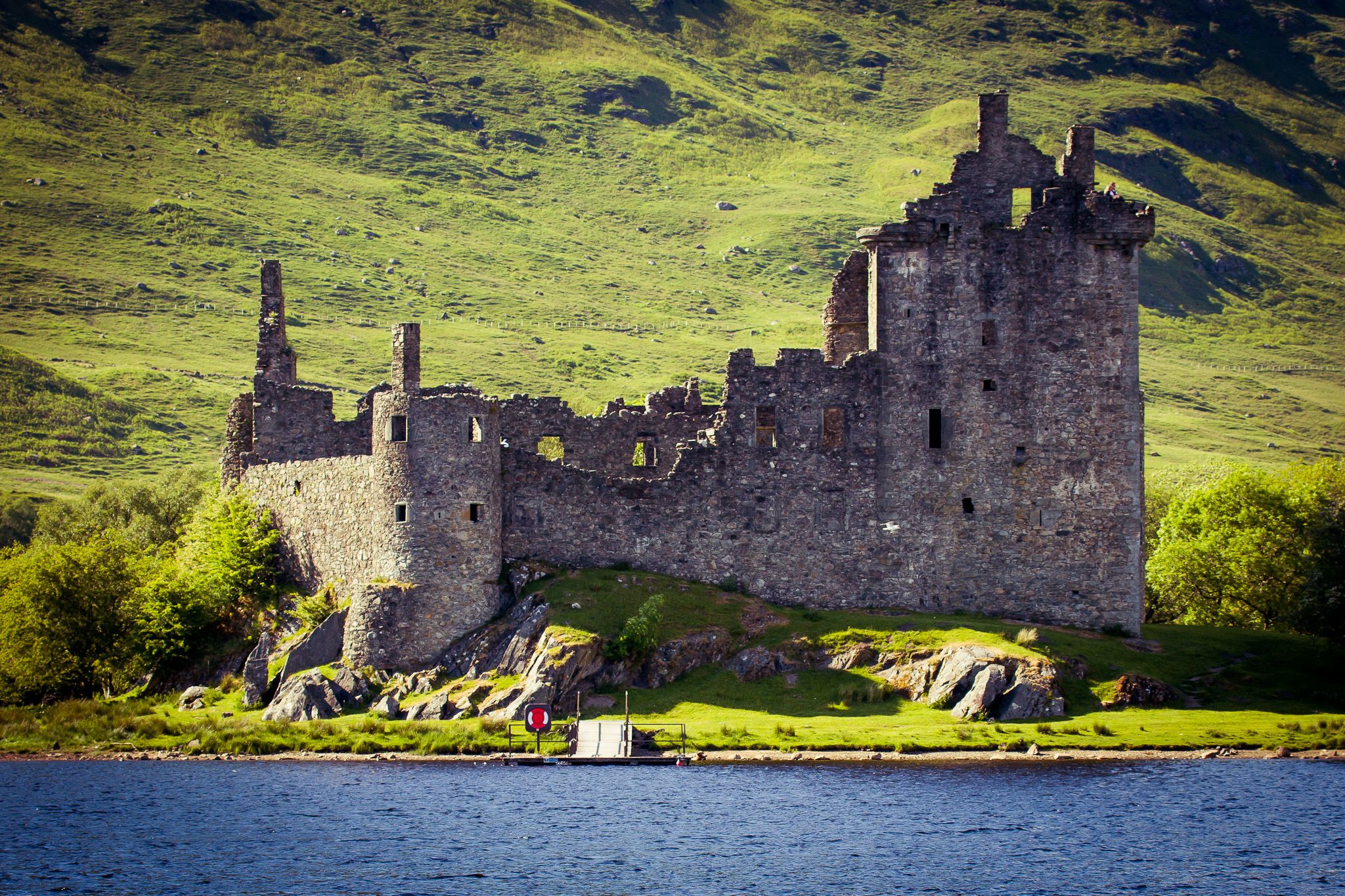
There is little left of the fort from which the town takes its name. The first castle here was constructed by General Monck in 1654 and called Inverlochy, but the meagre ruins by the loch are those of the fort built in the 1690s by General Mackay and named after King William II/III. In the 18th century it became part of a chain of garrisons (along with Fort Augustus and Fort George) that controlled the Great Glen in the wake of the Jacobite rebellions; it was pulled down in the 19th century to make way for the railway.
Originally a tiny fishing village called Gordonsburgh, the town adopted the name of the fort after the opening of the railway in 1901 (in Gaelic it is known as An Gearasdan, ‘the garrison’). The juxtaposition of the railway and the Caledonian Canal saw the town grow into a major tourist centre. Its position has been consolidated in the last three decades by the huge increase in popularity of climbing, skiing, mountain biking and other outdoor sports.
Beaches
The oldest signs of human settlement are Late Neolithic (4th millennium BC or earlier), but c. 2000–1650 BC Akrotiri developed into one of the Aegean’s major Bronze Age ports, with recovered objects that came not just from Crete, but also from Anatolia, Cyprus, Syria, and Egypt, as well as from the Dodecanese and the Greek mainland.


Sights to visit
Monastery
The oldest signs of human settlement are Late Neolithic (4th millennium BC or earlier), but c. 2000–1650 BC Akrotiri developed into one of the Aegean’s major Bronze Age ports, with recovered objects that came not just from Crete, but also from Anatolia, Cyprus, Syria, and Egypt, as well as from the Dodecanese and the Greek mainland.
Archaeological Museum
The oldest signs of human settlement are Late Neolithic (4th millennium BC or earlier), but c. 2000–1650 BC Akrotiri developed into one of the Aegean’s major Bronze Age ports, with recovered objects that came not just from Crete, but also from Anatolia, Cyprus, Syria, and Egypt, as well as from the Dodecanese and the Greek mainland.

Venetian Castle
The oldest signs of human settlement are Late Neolithic (4th millennium BC or earlier), but c. 2000–1650 BC Akrotiri developed into one of the Aegean’s major Bronze Age ports, with recovered objects that came not just from Crete, but also from Anatolia, Cyprus, Syria, and Egypt, as well as from the Dodecanese and the Greek mainland.